Categories
Saint Vincent and the Grenadines

Tobago Cays

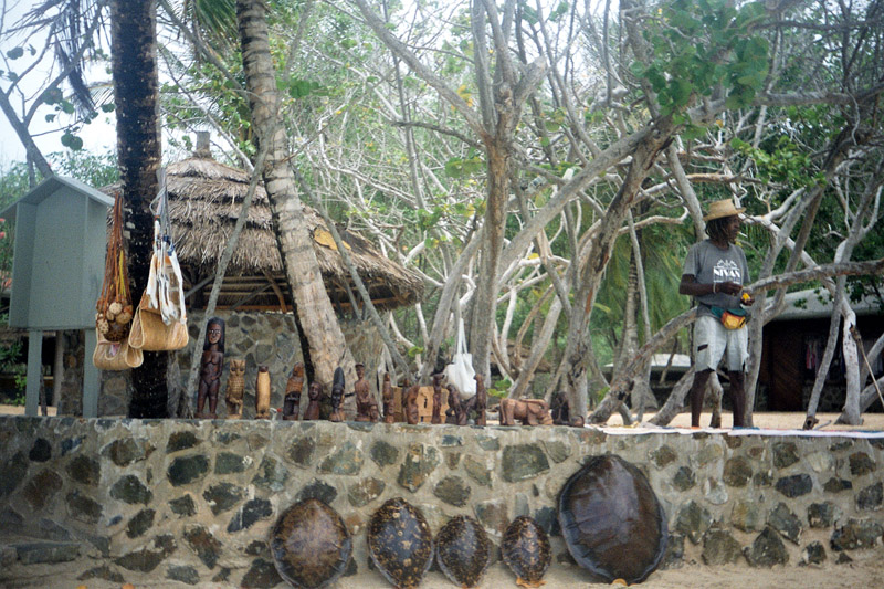
The Tobago Cays are an archipelago comprising five small uninhabited islands – Petit Rameau, Petit Bateau, Baradol, Petit Tobac and Jamesby – located in the Southern Grenadines. The Tobago Cays are now the key element of the Tobago Cays Marine Park, a national park and wildlife preserve run by the St.Vincent and the Grenadines government. The Tobago Cays Marine Park consists of a 1,400 acre sand-bottom lagoon which encompasses four uninhabited cays and the 4 km Horseshoe Reef. While the cays are uninhabited, they are surrounded by the three larger inhabited islands of Union Island, Mayreau and Canouan.

The most extensive and well-developed coral reef complexes in St. Vincent & the Grenadines occur on shallow shelves around the windward sides of Mayreau and Union Islands and the Cays themselves. In addition, principal vegetation types include beach vegetation and dry forest. With the exception of a small mangrove in Petit Rameau and salt pond in Mayreau, there are no wetlands in the Cays.

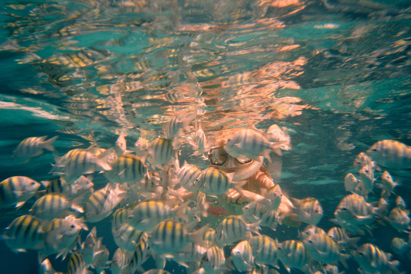
Major users of the area include: cruise ships (an estimated 50,000 visitors each year of which 10,000 visit the Cays); yachts (an estimated 3,000 yachts anchor in the lagoon each year); day charters (from nearby hotels); sport divers and snorkelers; and fishing enthusiasts.

Source: Wikipedia (under GNU Free Documentation License)

Categories
Barbados

Barbados

Barbados, situated just east of the Caribbean Sea, is a West Indian continental island-nation in the western Atlantic Ocean. After a brief claim by Spain in 1492 and later Portugal, Barbados became a colony and protectorate of the United Kingdom for over three centuries. The country currently maintains Queen Elizabeth II as head of state. Located at roughly 13° North of the equator and 59° West of the prime meridian, it is considered a part of the Lesser Antilles. Its closest island neighbours are Martinique, Saint Lucia, and Saint Vincent & the Grenadines to the west. To the south lies Trinidad and Tobago – with which Barbados now shares a fixed official maritime boundary – and also the South American mainland. Barbados’s total land area is about 430 square kilometres (166 square miles), and is primarily low-lying, with some higher in the country’s interior. The highest point in Barbados is Mount Hillaby in the parish of Saint Andrew.

The geological composition of Barbados is of non-volcanic origin, predominantly limestone-coral. After the break of South America from Africa in the Mesozoic, a reef formed. During the Cenozoic, as both the Caribbean and South American plates moved westward, the two plates impacted and pressed this reef upward. Barbados is part of a North Atlantic Ocean submarine mountain range located to the east of the Windward Islands. This range stretches from its close proximity of Puerto Rico in the north, to a south-easterly direction toward Venezuela. The island of Barbados forms the only part of this mountain range that rises above sea level.

The island’s climate is tropical, with constant trade winds off the Atlantic Ocean serving to keep temperatures mild. Some less developed areas of the country contain tropical woodland and mangroves. Other parts of the interior which contribute to the agriculture industry are dotted with large sugarcane estates and wide, gently sloping pastures, with panoramic views down to the coast also.

Source: Wikipedia (under GNU Free Documentation License)

Categories
Azores

Faial

Faial Island, also known in English as Fayal, is a Portuguese island of the Central group (Grupo Central) of the Azores. Its area is 173 km² and it is located 28.7° W longitude and 38.6° N latitude. The nearest island is Pico Island to the east. The island is also referred to as Ilha Azul (the “Blue Island”), by poet Raul Brandão, due to the large quantity of Hydrangeas that bloom during the summer months.

During a period of medieval legends and unsubstantiated stories of mystical lands, the island of Faial first appeared on the 1375-1377 Atlas Catalão, as Ilha da Ventura or Insula de La Ventura (Venture Island). By 1427 they had discovered what most had suspected: islands in the middle of the Atlantic (specifically the islands of Santa Maria and São Miguel). Subsequent years would occur new discoveries, until during his first voyage of exploration (in 1451) the navigator Diogo de Teive explored the coast of Faial.

It was the humanist friar Gaspar Frutuoso who recounted that the first explorers did not find a uninhabited island: a hermit, who had a small flock and lived in a cave in the interior, had occupied the land.

Source: Wikipedia (under GNU Free Documentation License)

Categories
Azores

São Miguel Island

São Miguel Island (Portuguese pronunciation: [sɐ̃ũ miˈɡɛɫ]; Portuguese for Saint Michael), nicknamed “The Green Island”, is the largest and most populous island in Portuguese Azores archipelago. The island covers 759 km2 (293 sq mi) and has around 140,000 inhabitants, 45,000 of these people located in the largest city in the archipelago: Ponta Delgada.

In 1427, São Miguel became the second of the islands discovered by Gonçalo Velho Cabral to be settled by colonists from the continent of Portugal. This date is uncertain, as it is believed that the island was discovered between 1426 and 1439 and inscribed in portolans from the middle of the 14th Century. In the early 1400s Infante D. Henrique authorized the settlement of the Azores, and many settlers from Estremadura, Alto Alentejo, Algarve and Madeira traveled to São Miguel, under the Carta Régia (a decree of the regency). Settlers from other countries, notably French people and cultural minorities such as Jews and Moors also came in this early settlement phase, due to the fertile soils and temperate climate. A military garrison was quickly established, and the Azorean ports became obligatory ports-of-call on African and Asian commerical trade. São Miguel became a center for the production of sugar and orchil, a dye exported to Flanders for the making of cloth.

Source: Wikipedia (under GNU Free Documentation License)

Categories
Madeira

Porto Santo Island

Porto Santo Island is a Portuguese island 43 km northeast of Madeira Island in the North Atlantic Ocean. It is the northernmost and the easternmost island of the Madeira Archipelago. The municipality has no land boundaries and is encircled by the Atlantic Ocean. Administratively, it is part of the Autonomous Region of Madeira. The length of the island is about 11 km and width is about 6 km. The population in 2001 was 4,474 with a density of 106.1/km².

The main urban area – which is one of only five Portuguese municipalities that have only one parish – is the city of Vila Baleira, also known as the city of Porto Santo. The island has an airport which serves flights to Funchal, which is only a 15-minute flight away. The nearest place is Machico on the island of Madeira to the southwest, which serves as its port to Funchal. The main industry of Porto Santo Island is tourism.

The island’s geography includes farmlands in the southern and central parts and further to the south a long shoreline with a few beaches, forests and grasslands to the west, rocky ledges and cliffs with a longer coastline to its north, forests to the northeast, drylands with grasses to the northern part and mountains along the northeastern part with about five to six main mountaintops with a few grasslands.

Source: Wikipedia (under GNU Free Documentation License)

Categories
Madeira

Madeira

Madeira is a Portuguese archipelago that lies between 32°22.3′N 16°16.5′W in the north Atlantic Ocean. It is one of the Autonomous regions of Portugal, with Madeira Island and Porto Santo Island being the only inhabited islands. Madeira is part of the EU as an outermost region of the European Union

Madeira was discovered by Portuguese sailors some time between 1418 and 1420. The archipelago is considered to be the first discovery of the exploratory period initiated by Henry the Navigator of Portugal. It is a popular year-round resort, noted for its Madeira wine, flowers, and embroidery artisans, as well as its New Year’s Eve celebrations that feature a spectacular fireworks show, which is the largest in the world according to the Guinness World Records. Its harbour – Funchal – is important due to its commercial and passenger traffic and for being a major stopover for cruisers en route from Europe to the Caribbean.

Madeira island is 520 km (323.11 mi) from the African coast and 1,000 km (621.37 mi) from the European continent, which is the equivalent of a 1 hour 30 minute flight from Lisbon.

Madeira Island is the largest island of the group with an area of 741 km2 (286 sq mi), a length of 57 km (35 mi), a breadth of 22 km (14 mi) at its widest point, and a coastline of 150 km (93.21 mi). Its longer axis lies east and west, along which lies a mountain chain with a mean altitude of 4,000 feet (1,220 m), considered the backbone of the island from which many deep ravines radiate outward to the coast. Its most famous sea cliff, the Cabo Girão, is one of the highest in Europe. The highest point on the island is Pico Ruivo, at 1,862 metres (6,107 ft).

Source: Wikipedia (under GNU Free Documentation License)