Categories
Indonesia

Bali

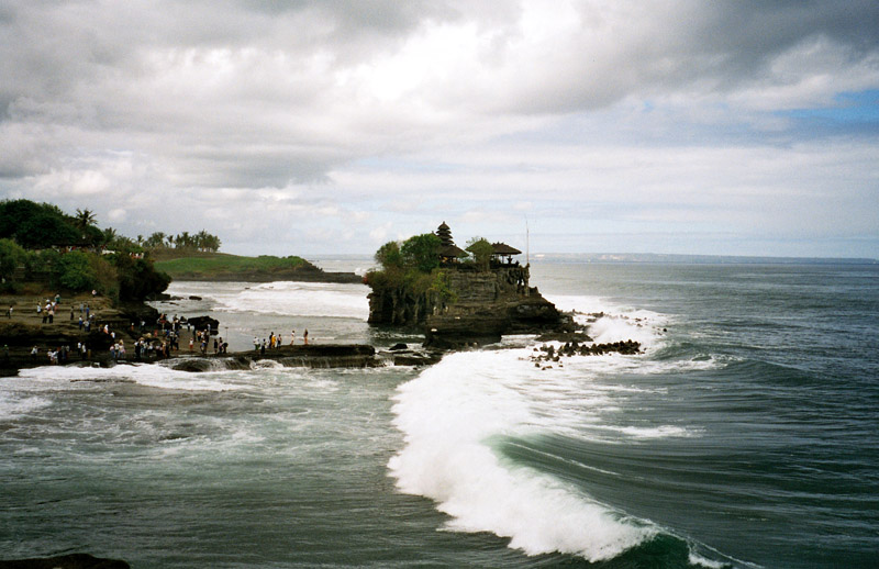
Bali is an Indonesian island located at the westernmost of the Lesser Sunda Islands, lying between Java to the west and Lombok to the east. It is one of the country’s 33 provinces with the provincial capital at Denpasar towards the south of the island.

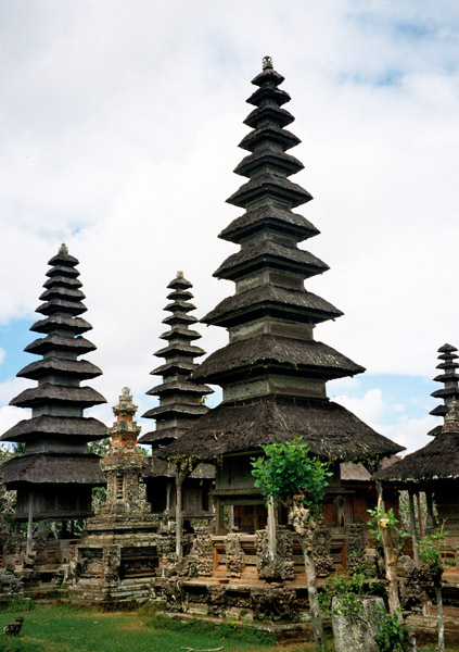
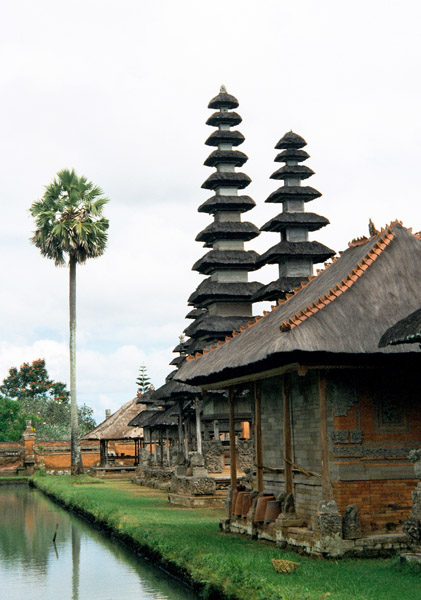
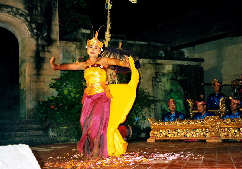
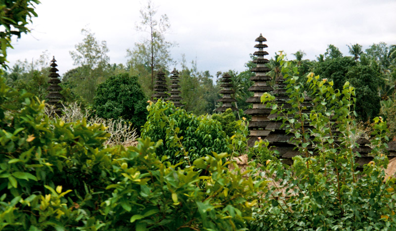
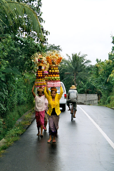
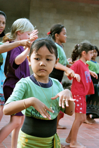
With a population recorded as 3,551,000 in 2009, the island is home to the vast majority of Indonesia’s small Hindu minority. 93.18% of Bali’s population adheres to Balinese Hinduism, while most of the remainder follow Islam. It is also the largest tourist destination in the country and is renowned for its highly developed arts, including dance, sculpture, painting, leather, metalworking and music.

Bali was inhabited by Austronesian peoples by about 2000 BC who migrated originally from Taiwan through Maritime Southeast Asia. Culturally and linguistically, the Balinese are thus closely related to the peoples of the Indonesian archipelago, the Philippines, and Oceania. Stone tools dating from this time have been found near the village of Cekik in the island’s west.

Source: Wikipedia (under GNU Free Documentation License)

Categories
Saint Vincent and the Grenadines

Tobago Cays

The Tobago Cays are an archipelago comprising five small uninhabited islands – Petit Rameau, Petit Bateau, Baradol, Petit Tobac and Jamesby – located in the Southern Grenadines. The Tobago Cays are now the key element of the Tobago Cays Marine Park, a national park and wildlife preserve run by the St.Vincent and the Grenadines government. The Tobago Cays Marine Park consists of a 1,400 acre sand-bottom lagoon which encompasses four uninhabited cays and the 4 km Horseshoe Reef. While the cays are uninhabited, they are surrounded by the three larger inhabited islands of Union Island, Mayreau and Canouan.

The most extensive and well-developed coral reef complexes in St. Vincent & the Grenadines occur on shallow shelves around the windward sides of Mayreau and Union Islands and the Cays themselves. In addition, principal vegetation types include beach vegetation and dry forest. With the exception of a small mangrove in Petit Rameau and salt pond in Mayreau, there are no wetlands in the Cays.

Major users of the area include: cruise ships (an estimated 50,000 visitors each year of which 10,000 visit the Cays); yachts (an estimated 3,000 yachts anchor in the lagoon each year); day charters (from nearby hotels); sport divers and snorkelers; and fishing enthusiasts.

Source: Wikipedia (under GNU Free Documentation License)

Categories
Madeira

Porto Santo Island

Porto Santo Island is a Portuguese island 43 km northeast of Madeira Island in the North Atlantic Ocean. It is the northernmost and the easternmost island of the Madeira Archipelago. The municipality has no land boundaries and is encircled by the Atlantic Ocean. Administratively, it is part of the Autonomous Region of Madeira. The length of the island is about 11 km and width is about 6 km. The population in 2001 was 4,474 with a density of 106.1/km².

The main urban area – which is one of only five Portuguese municipalities that have only one parish – is the city of Vila Baleira, also known as the city of Porto Santo. The island has an airport which serves flights to Funchal, which is only a 15-minute flight away. The nearest place is Machico on the island of Madeira to the southwest, which serves as its port to Funchal. The main industry of Porto Santo Island is tourism.

The island’s geography includes farmlands in the southern and central parts and further to the south a long shoreline with a few beaches, forests and grasslands to the west, rocky ledges and cliffs with a longer coastline to its north, forests to the northeast, drylands with grasses to the northern part and mountains along the northeastern part with about five to six main mountaintops with a few grasslands.

Source: Wikipedia (under GNU Free Documentation License)

Categories
Madeira

Madeira

Madeira is a Portuguese archipelago that lies between 32°22.3′N 16°16.5′W in the north Atlantic Ocean. It is one of the Autonomous regions of Portugal, with Madeira Island and Porto Santo Island being the only inhabited islands. Madeira is part of the EU as an outermost region of the European Union

Madeira was discovered by Portuguese sailors some time between 1418 and 1420. The archipelago is considered to be the first discovery of the exploratory period initiated by Henry the Navigator of Portugal. It is a popular year-round resort, noted for its Madeira wine, flowers, and embroidery artisans, as well as its New Year’s Eve celebrations that feature a spectacular fireworks show, which is the largest in the world according to the Guinness World Records. Its harbour – Funchal – is important due to its commercial and passenger traffic and for being a major stopover for cruisers en route from Europe to the Caribbean.

Madeira island is 520 km (323.11 mi) from the African coast and 1,000 km (621.37 mi) from the European continent, which is the equivalent of a 1 hour 30 minute flight from Lisbon.

Madeira Island is the largest island of the group with an area of 741 km2 (286 sq mi), a length of 57 km (35 mi), a breadth of 22 km (14 mi) at its widest point, and a coastline of 150 km (93.21 mi). Its longer axis lies east and west, along which lies a mountain chain with a mean altitude of 4,000 feet (1,220 m), considered the backbone of the island from which many deep ravines radiate outward to the coast. Its most famous sea cliff, the Cabo Girão, is one of the highest in Europe. The highest point on the island is Pico Ruivo, at 1,862 metres (6,107 ft).

Source: Wikipedia (under GNU Free Documentation License)