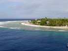
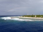
Rangiroa (meaning “Vast Sky” in Tuamotuan) or Te Kokota, is the largest atoll in the Tuamotus, and one of the largest in the world (although it is smaller than Kwajalein in the Marshall Islands and Huvadhu in the Maldives). It is located in the Palliser group. The nearest atoll is Tikehau, located only 12 km to the West.
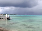
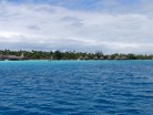
The atoll consists of about 250 islands, islets and sandbars comprising a total land area of about 170 km². There are approximately 100 narrow passages, called hoa, in the fringing reef. The lagoon is approximately 1600 km². It is so large that it has its own horizon.
The chief town is Avatoru, located in the northwestern part of the atoll. Rangiroa has a total of 2334 inhabitants (2002 census).
The first recorded Europeans to arrive to Rangiroa were Dutch explorers Jacob le Maire and Willem Schouten during their 1615-1616 Pacific journey. They called this atoll “Vlieghen Island”.
Rangiroa appears in some maps as “Nairsa” or as “Dean’s island”. This atoll was visited by the Charles Wilkes expedition on September 7, 1839.
There is a territorial (domestic) airfield in Rangiroa which was inaugurated in 1965.
