Categories
Indonesia

Komodo

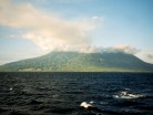
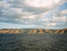
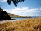
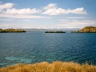
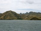
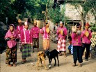
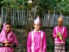
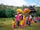
Komodo is one of the 17,508 islands that make up the Republic of Indonesia. The island has a surface area of 390 km² and over 2000 inhabitants. The inhabitants of the island are descendants of former convicts who were exiled to the island and who have mixed themselves with the Bugis from Sulawesi. The population are primarily adherents of Islam but there are also Christian and Hindu minorities.

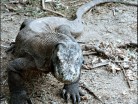
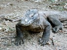
Komodo is part of the Lesser Sunda chain of islands and forms part of the Komodo National Park. Particularly notable here is the native Komodo dragon. In addition, the island is a popular destination for diving. Administratively, it is part of the East Nusa Tenggara province.

Komodo lies between the substantially larger neighboring islands Sumbawa to the west and Flores to the east.

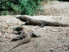
The island is famous not only for its heritage of convicts but also for the unique fauna which roam it. The Komodo dragon, the world’s largest living lizard, takes its name from the island. A type of monitor lizard, it inhabits Komodo and some of the smaller surrounding islands.

Source: Wikipedia (under GNU Free Documentation License)

Categories
Indonesia

Sumbawa

Sumbawa is an Indonesian island, located in the middle of the Lesser Sunda Islands chain, with Lombok to the west, Flores to the east, and Sumba further to the southeast. It is in the province of West Nusa Tenggara.

Sumbawa is 15,448 km² (three times the size of Lombok) with a population of around 1.5 million. It marks the boundary between the islands to the west, which were influenced by religion and culture spreading from India, and the region to the east that was not so influenced.

Four principalities in western Sumbawa were dependencies of the Majapahit Empire of eastern Java. Because of Sumbawa’s natural resources it was regularly invaded by outside forces – Japanese, Dutch, Makassarese. The Dutch first arrived in 1605, but did not effectively rule Sumbawa until the early 20th century. The Balinese kingdom of Gelgel ruled western Sumbawa for a short period as well. It was also home to the Sultanate of Bima.

Source: Wikipedia (under GNU Free Documentation License)

Categories
Mauritius

Rodrigues

Rodrigues, sometimes spelled Rodriguez but named after the Portuguese explorer Diogo Rodrigues, is the smallest of the Mascarene Islands and a dependency of Mauritius. With a peak elevation of approximately 355 meters, it is located 560 km east of Mauritius island, in the middle of the Indian Ocean. It is 109 km² in size, and surrounded by a coral reef. The capital of the island is Port Mathurin.

As of 2006, the island’s population was about 40,000. The main language is Rodriguan Creole, while French and English are spoken or understood by some of the inhabitants. The main religion is Roman Catholicism with a small minorities of other religions. Most of the inhabitants are of mixed African and French descent. The main industries are handicraft, farming, fishing and tourism.

Source: Wikipedia (under GNU Free Documentation License)

Categories
Seychelles

Praslin

Praslin is the second largest island (38 km²) of the Seychelles, lying 44 km north east of Mahé. Praslin has a population of around 6,500 people and comprises two administrative districts; Baie Sainte Anne and Grand’ Anse (Praslin). The main settlements are the Baie Ste Anne, Anse Volbert and Grand’ Anse.

It was named Isle de Palmes by explorer Lazare Picault in 1744. During that time it was used as a hideaway by pirates and Arab merchants. In 1768 it was renamed Praslin in honor of French diplomat César Gabriel de Choiseul, duc de Praslin.

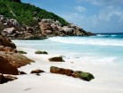
Praslin is known as a tourist destination with several hotels and resorts, as well as a number of beaches such as Anse Lazio and Anse Georgette. It also has substantial tracts of tropical forests with birds such as the endemic Seychelles Bulbul and the Seychelles Black Parrot. The beautiful Vallée de Mai Nature Preserve is known for the unique coco de mer and vanilla orchids. It has been reported that General Charles George Gordon of Khartoum (1833-1885) was convinced that Vallée de Mai was the Biblical “Garden of Eden”.

Source: Wikipedia (under GNU Free Documentation License)

Categories
Seychelles

Mahé I

Mahé is the largest island (155 km²) of the Seychelles, lying in the north east of the nation. The population of Mahé is 80,000. It contains the capital city of Victoria and accommodates 90% of the country’s total population. The island was named after Bertrand-François Mahé de La Bourdonnais, a French governor of Mauritius.

Mahé’s tallest peak is Morne Seychellois at 905 m, which lies in the Morne Seychellois National Park. The northern and eastern parts of the island are home to much of the population and the international airport which opened in 1971. The southern and western parts have Baie Ternay Marine National Park and Port Launay Marine National Park. The Ste Anne Marine National Park lies offshore, as do Conception Island, Thérèse Island, Anonyme Island and Silhouette Island.

Mahé was first visited by the British in 1609 and not visited by Europeans again until Lazare Picault’s expedition of 1742. Mahé remained a French possession until 1812 when it became a British colony. It remained a colony until 1976 when Seychelles became an independent nation.

Source: Wikipedia (under GNU Free Documentation License)

Categories
Seychelles

La Digue I

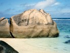
La Digue is the fourth largest inhabited island of the Seychelles, lying east of Praslin and west of Felicite Island. It has a population of about 2,000 people, who mostly live in the west coast villages of La Passe (linked by ferry to Praslin and Mahé) and La Réunion. It has an area of 10 km². La Digue is named after a ship in the fleet of French explorer Marc-Joseph Marion du Fresne, who visited the Seychelles in 1768.

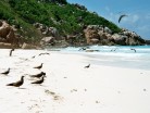
Today the island’s main industry is tourism and is known for its beaches especially Anse Source d’Argent. In former times copra and vanilla production were mainstays of the local economy; which is commemorated in the island’s museum. In the island’s interior is Veuve Nature Reserve, home of the rare Black Paradise Flycatcher, of which there are only about 100 in existence. La Digue’s tallest peak is also in the central part of the island, Belle Vue (Eagle’s Nest Mountain), with its summit more than 300 meters above sea level.

Source: Wikipedia (under GNU Free Documentation License)

Categories
Seychelles

Curieuse

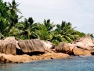
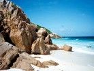
Curieuse Island is a small granitic island (1.78 sq mi) in the Seychelles close to the north coast of the island of Praslin. Curieuse is notable for its bare red earth intermingled with the unique Coco de Mer palms, one of the cultural icons of the Seychelles, only being present on the two islands.

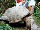
Originally named Ile Rouge due to the red coloured soil, in 1768 the French claimed possession of the island and named it after a schooner “La Curieuse” which was under the command of explorer Marc-Joseph Marion du Fresne. Like many of the Seychelles islands there was a native giant tortoise population that was quickly extirpated.

In 1771 sailors set fire to the island, intending to make harvesting the coco de mer nuts easier. The fire destroyed many of the islands forests and its native trees and today indications of the fire can still be seen nearly 250 years on.

Source: Wikipedia (under GNU Free Documentation License)

Categories
Seychelles

Aride

Aride Island is the northernmost granitic island in the Seychelles and is 10km north of Praslin. It is 68 hectares in area and is a nature reserve. Aride is leased and managed by the Island Conservation Society of Seychelles. The only human inhabitants are the reserve’s staff; currently four Seychellois rangers and two wardens. They live in small plantation houses on the south side of the island.

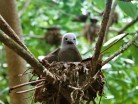
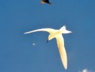
Over 1.25 million seabirds regularly breed on Aride including the world’s largest colony of lesser noddy, the largest Seychelles population of roseate terns and the world’s largest colony of Audubon’s Shearwater. There is also an enormous roost of non-breeding frigatebirds. The Seychelles Warbler was introduced from Cousin Island to Aride in 1988 and its population is now the largest in the world with over 2,000 pairs. The Seychelles Fody was also introduced from Cousin in 2002, as well the Seychelles Magpie Robin from Fregate Island. The Seychelles Blue Pigeon and the Seychelles Sunbird have re-colonised Aride naturally.

Source: Wikipedia (under GNU Free Documentation License)

Categories
Mauritius

Mauritius I

Mauritius (pronounced /məˈrɪʃəs/; French: L’île Maurice pronounced: [lil mɔˈʁis], Mauritian Creole: Moris), officially the Republic of Mauritius, French: République de Maurice is an island nation off the coast of the African continent in the southwest Indian Ocean, about 900 kilometres (560 mi) east of Madagascar. In addition to the island of Mauritius, the Republic includes the islands of Cargados Carajos, Rodrigues and the Agalega Islands. Mauritius is part of the Mascarene Islands, with the French island of Réunion 200 km (120 mi) to the southwest and the island of Rodrigues 570 km (350 mi) to the northeast.

The island of Mauritius is renowned for having been the only known home of the dodo. First sighted by Europeans around 1600 on Mauritius, the dodo became extinct less than eighty years later.

The island was known by Arab and Austronesian sailors as early as the 10th century. The Portuguese sailors first visited it in 1507 and established a visiting base leaving the island uninhabited. Three ships of the eight Dutch Second Fleet that were sent to the Spice Islands were blown off course during a cyclone and landed on the island in 1598, naming it in honour of Prince Maurice of Nassau, the Stadtholder of the Netherlands. In 1638, the Dutch established the first permanent settlement. Because of tough climatic conditions including cyclones and the deterioration of the settlement, the Dutch abandoned the island some decades later. France, which already controlled the neighbouring Île Bourbon (now Réunion) seized Mauritius in 1715 and later renamed it Île de France (Isle of France). Under French rule, the island developed a prosperous economy based on sugar production. In the Napoleonic Wars (1803-1815) the British set out to gain control of the island. Despite winning the Battle of Grand Port, Napoleon’s only naval victory over the British, the French surrendered to a British invasion at Cap Malheureux three months later. They formally surrendered on 3 December 1810, on terms allowing settlers to keep their land and property and to use the French language and law of France in criminal and civil matters. Under British rule, the island’s name reverted to the original one.

Source: Wikipedia (under GNU Free Documentation License)
Categories
Saint Vincent and the Grenadines

Union Island

Union Island is part of the nation of St. Vincent and the Grenadines. It the southernmost island of the Grenadines. It lies 90 kilometers southwest of Barbados and is within view of the islands of Carriacou and the mainland of Grenada, which lie directly south.

Clifton and Ashton are the two principal towns. The island is home to approximately 3,000 residents. The official language is English, but French and German are spoken by some merchants in Clifton as well.

The island has an international airport which has domestic flights to Saint Vincent and some of the Grenadines and international flights to Barbados, Carriacou, Grenada and Martinique. Airlines flying into Union Island are not IATA members and itineraries will not be visible to more non-regional travel agents – visitors interested in travel to the islands will need to contact the airlines directly or contact a local travel agency. Daytime flights only, as there are no runway lights.

Source: Wikipedia (under GNU Free Documentation License)