Categories
Cape Verde

São Vicente

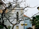
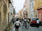
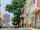
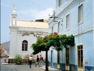
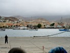
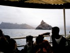
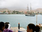
São Vicente (Portuguese for “Saint Vincent”), also Son Visent or Son Sent in Cape Verdean Creole, is one of the Barlavento islands of Cape Verde. It is located between the islands of Santo Antão and Santa Luzia, with the Canal de São Vicente separating it from Santo Antão.

The island is composed by a single administrative division, the São Vicente municipality. It includes all the island of São vicente plus the nearby uninhabited Santa Luzia island to the southeast. The “Dia do Município” or “Municipality Day” is on January 22. The municipality includes only one parish, Nossa Senhora da Luz.

The island is roughly rectangular in shape with a surface area of ca. 227 km2 (88 sq mi). From east to west it measures 24 km (15 mi) and from north to south no more than 16 km (9.9 mi). The terrain includes mountains in the west, the southwest, the south, the east-central and the north. The area is flat in the north-central, the central part, the eastern part south of Calhau and the northern part in the Baía das Gatas area. The urban area of Mindelo is in the northern part. Much of the island is deforested.
Source: Wikipedia (under GNU Free Documentation License)

Categories
Thailand

Ko Phi Phi Don

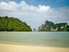
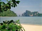
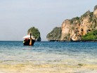
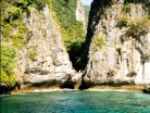
Ko Phi Phi Don is the largest of the Phi Phi Islands, in Thailand. It is the only island in the group with permanent inhabitants. Like the other islands in the group, Ko Phi Phi Don is a non-volcanic island largely made of limestone. It is almost separated into two islands, but a strand of flat land connects them. On this strand lies the largest town on the island, as well as most of the resorts.

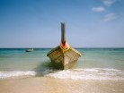
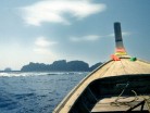
Ko Phi Phi Don is now squarely on the tourist map, and tourists from all over the world (especially Europe, Japan, and the wealthier Southeast Asian countries) flock to the island. Accessible from Phuket and mainland Krabi province, all tourists must arrive by boat. (The trip from Phuket takes around 90 minutes.) This has essentially turned the island into a rush of day trippers who overpopulate the island from 11AM-3PM. The island still holds much charm that can be enjoyed in the hours that the flocks from Phuket are not there. While in former times, Ko Phi Phi Don was a serene paradise, parts of it (especially the Ton Sai Bay area) have been exploited for tourism. Restaurants, shops, internet cafes, and shanty towns abound.

Source: Wikipedia (under GNU Free Documentation License)

Categories
Thailand

Ko Phi Phi Leh

Ko Phi Phi Leh (or Ko Phi Phi Ley) is an island of the Phi Phi archipelago, in the Andaman Sea. It belongs to the Krabi province of Thailand.

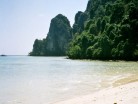
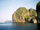
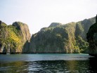
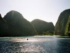
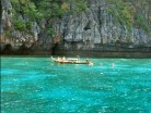
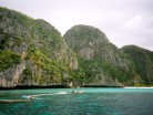
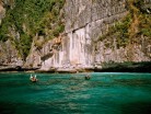
Ko Phi Phi Leh is the second largest island of the archipelago, the largest one being Ko Phi Phi Don. The island consists of a ring of steep limestone hills surrounding a shallow bay, the Mahya Bay.

Mahya Bay (or Maya Bay) is popular for diving, and has become even more popular after the 2000 movie The Beach was filmed there. According to the Lonely Planet’s Thailand guidebook, the 2004 tsunami dramatically improved the look of Maya Bay. This was due to the fact that the high waves had cleaned up the beach and removed all the landscaping the Fox production team had added.

Controversy arose during the making of the film The Beach due to 20th Century Fox bulldozing and rescaping of the natural beach setting of Ko Phi Phi Leh to make it more “paradise-like”. The production altered some sand dunes and cleared some coconut trees and grass to widen the beach. Fox set aside a fund to reconstruct and return the beach to its natural state, however lawsuits were filed as many believed the damage to the ecosystem is permanent and restoration attempts failed.

The lawsuits dragged on for years. In 2006, Thailand’s Supreme Court upheld an appeal court ruling that the filming had harmed the environment and ordered that damage assessments be made. Defendants in the case included 20th Century Fox and some Thai government officials.

Source: Wikipedia (under GNU Free Documentation License)

Categories
Indonesia

Komodo

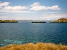
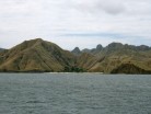
Komodo is one of the 17,508 islands that make up the Republic of Indonesia. The island has a surface area of 390 km² and over 2000 inhabitants. The inhabitants of the island are descendants of former convicts who were exiled to the island and who have mixed themselves with the Bugis from Sulawesi. The population are primarily adherents of Islam but there are also Christian and Hindu minorities.

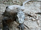
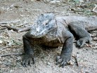
Komodo is part of the Lesser Sunda chain of islands and forms part of the Komodo National Park. Particularly notable here is the native Komodo dragon. In addition, the island is a popular destination for diving. Administratively, it is part of the East Nusa Tenggara province.

Komodo lies between the substantially larger neighboring islands Sumbawa to the west and Flores to the east.

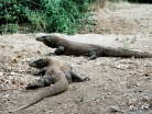
The island is famous not only for its heritage of convicts but also for the unique fauna which roam it. The Komodo dragon, the world’s largest living lizard, takes its name from the island. A type of monitor lizard, it inhabits Komodo and some of the smaller surrounding islands.

Source: Wikipedia (under GNU Free Documentation License)